This is not an official hiking trail and it has no official name, these two facts combine to explain why it isn't overrun with hikers. It is the access trail for the water conduit from the Ludgate Lake reservoir to the NB Power generating station at Coleson Cove . . . (water conduit = aqueduct – so I call it the Aqueduct Trail . . . that works for me.)
Where – Hwy #1, West of Saint John, NB – Lat/Long 45º11'49.57" North, 66º12'54.36 West . Use these coordinates to look it up on Google Earth and get a god’s eye view of the lay of the land.
Access – Directly to the south side of Hwy #1 about halfway between the exit for the Spruce Lake Industrial Park and the exit for Prince of Wales. If you can see Ludgate Lake on the north side of the highway, la,
 | |||||||
| Ludgate Lake to the North |

look for this pumphouse and gate on the south side – that’s the trailhead . . .
If you are coming from Saint John take the Prince of Wales exit and come back on the eastbound lanes of Hwy #1 so you can park on the south side of the highway.
There is no parking area per se but the shoulder of the road is broad enough to safely park near the gate. The trailhead is easily recognized but not signed. Once through the gate, past the pumphouse and a hundred metres or so past the open area beyond (the natural gas pipeline right-of-way) you should be okay to get naked.
Length – Trailhead to turnaround point is approx 2.2 km, a nice short hike with the added benefit of it being all in the open so you can work on your tan while you hike.
Degree of difficulty – Easy
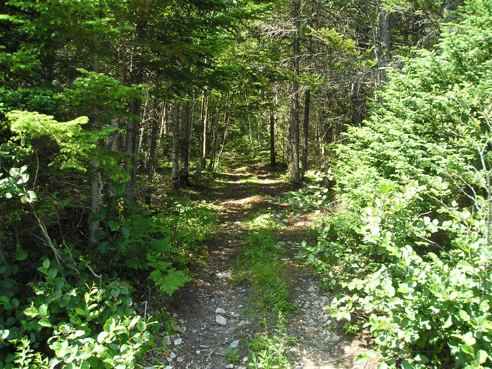
Description – The trail is a single lane with loose stone cover, is wide enough for ATVs and shows clear signs of being used by them. There is scrub vegetation to the left that gets bush hogged every ten years or so. To the right there is mixed forest, fairly thick and owned by the Nature Conservancy of Canada – you’ll see their signs every now and then. This photo shows the long views typical of this trail . . .

. . . so if you see someone coming in the distance you have plenty of time either to slip into something less comfortable or to step off into the forest and wait for them to pass by.
Suitability for naked hiking – I know that this trail is used by ATVers because I’ve seen the tracks, but having hiked there 25-30 times over the last ten years I have yet to see an ATVer (or anyone else) out and about.
Overnighting – not recommended. However, I know that some people have camped overnight at Cheeseman Beach –see Note 2, Option C below and my Cheeseman Beach blogpost.
Important Notes:
1. About three-quarters of the way between the trailhead and the second set of power lines there is a forest trail branching off to the RIGHT, la:
This trail leads to Connors Lake, a fairly substantial lake surrounded by bog, and with a disreputable shanty erected by some ATVers who obviously have no intention of ever removing their garbage. Before you get to the lake or the shanty the forest trail turns LEFT to join the service trail beneath the power lines and takes you back to the Aqueduct Trail after a detour of 1.6 km.
2. When you get to the turnaround point, easily recognized as a wide open area in the middle of nowhere, you have a number of options open to you:
Option A, turn around and go back to the trailhead.
Option B, go straight. This is NOT a good option. Another 200 metres brings you to the Burchill Stream where, many years ago, the roadway had been washed out quite comprehensively. Not recommended.
Option C, turn RIGHT and follow the overgrown road 300 metres to where the bridge that crossed Frenchmans Creek was washed away many more years ago.
At LOW TIDE you can easily walk across the stream without getting your boots damp.
At HIGH TIDE this is PERILOUS, read "STUPID" because the water at high tide can be 10 feet deep.
IF you intend to cross the creek check the tide tables to make sure you have enough time to get back before the rising tide starts to flood the creek.
If you make a low tide crossing another 600 metres of bushwhacking will bring you to Cheeseman Beach.
ONCE AGAIN, MAKE SURE THAT YOU HAVE PLENTY OF TIME TO GET BACK.
Visit this DFO website for a current tide table.
Option D, turn LEFT and follow the much improved dirt track 800 metres uphill to the Burchill Road, which is a more or less abandoned paved road heavily grown in with brush on both sides (as of August 2019) and barely wide enough for a single vehicle. However, it is sometimes used by the Coleson Cove workers as a lunch site, mostly at the dead end near Hwy #1. Sadly, some of the locals find it convenient to dump their junk on either side of the road – not very edifying. From the Burchill Road junction you can exercise either of two options:
Option D1, turn around and go back the way you came, all the way to the trailhead. This makes for a hike with a total return distance of 6 km; or you can try
Option D2, turn LEFT on the Burchill Road and follow it to the dead end, turn LEFT again and follow the ATV track along the pipeline right-of-way back to the pumphouse trailhead, a total return distance of 5.3 km. The good thing about the brush growing in on the sides of the road is that you can get under cover in a moment if you hear a vehicle approaching. Have a close look at this option on Google Earth before you decide to do it.
I have done all of these options at one time or another and have confirmed them all on 03 August 2019.
These write-ups are great, thank you! I am always looking for places to hike in the nude without offending anyone. I will definitely be doing this hike before the summer ends. Thanks!
ReplyDeleteSuccess! I had a great walk (option D2). I didn't encounter anyone except an angry pheasant. But once I realized I was bigger and louder than him, he quickly turned tail and ran. I got the feeling that it would be rare to meet someone on foot and that most encounters would likely be with vehicular traffic (which you could hear coming a mile away). I expect I will be returning to this trail again someday. Thanks again!
DeleteYou are entirely welcome. I'm glad to hear that it worked out for you.
ReplyDeleteAny recommendations for guy to find a nude area to tan and or swim near NorthNB or within a few hours either way...?
DeleteNo, sorry, you'll have to work that out for yourself. New Brunswick has a lot of isolated places where it is possible to pursue a naturist lifestyle with relative ease. Consider your location, take a look at a decent map to choose a likely area then go to Google Earth and have a close looked at what's where. Finally, take a drive to the area and confirm the situation on the ground. It will take some work and a bit of trial and error but there are always private places to be found.
DeleteI parked on the shoulder by the Burchill deadend because vehicles were parked at the pump station. I trekked down Burchill road until I reached the quarry. I was always looking over my shoulder, cautious that a vehicle might drive up behind me. The vegetation on either end if the road makes it impossible to see or hear around the bend, but I was comfortable enough to stroll for 10mins in nothing but my boots. I never did see anyone and could've done the entire walk naked, but hindsight is 20/20.
ReplyDeleteIt would be exciting to bump into another disrobed walker while on the road. I think I'll be going out there often until it gets too cold. I'll explore the Aqueduct trail next time.
Thanks for the write up :)
I’m gonna do this tomorrow 8/28/23 anyone want to join me😎
ReplyDeleteI wish I would have seen this comment, I surely would have joined !
DeleteDid this hike today,they have put in a culvert at the washout and now can safely cross to continue on to a very nice at shack with porta potty’s.Very nice walk in the nude most of the way there and back,other than a mountain biker sneaking up on me to tell me I had a nice butt,I had a very enjoyable hike.Will definitely be doing this weekly if not more.
ReplyDeleteThe weather is getting nice. Anyone thinking of doing this hike in the near future. I have done the trail by coleson cove that heads back towards lorneville and comes out by the wind mill nude.
ReplyDeleteAnyone done this hike this year?
ReplyDeleteno ,,but i would love to with someone
Deletewould love to do the hike with someone if interested
ReplyDeleteDid that trail the whole way through to the beach. Only meant a dirt bike. He didnt even look sideways. The weather is nice this week would love to try it again with someone joe.
ReplyDeletewould love to do the trail with someone
ReplyDeleteNice time of year to go for a walk. Anybody do this hike
ReplyDelete